Physical Geography
SDSU Geographers include specialists in climate, water, and ecosystems. Students in this area study the physical processes operating in the environment, and the human interactions with those physical processes. Techniques include applied Geographic Information Systems (GIS), remote sensing, modeling, and fieldwork. Careers for students in this field include consulting, government, and academic careers in environmental areas.
Specialities
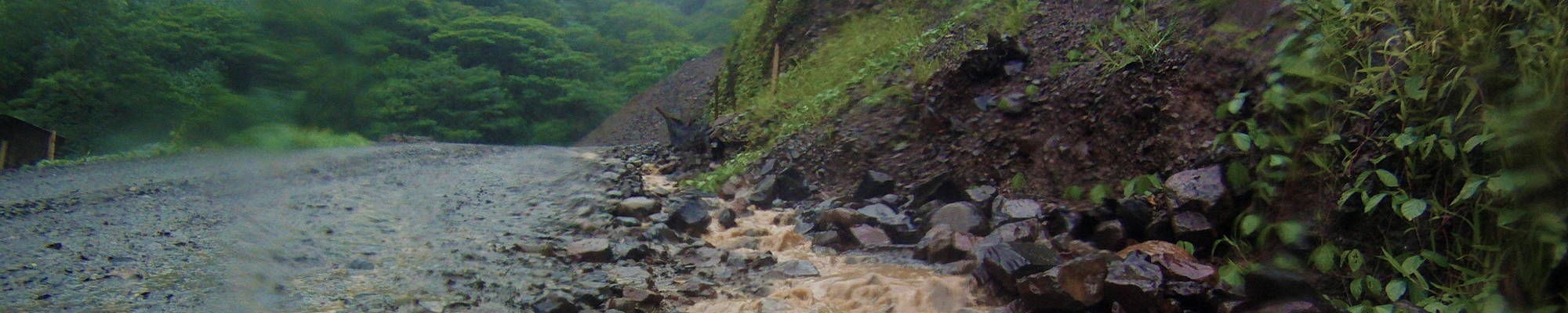
Hydrology and watershed analysis is the science of understanding how water moves through watersheds, and using that knowledge to preserve the world’s valuable water resources and use them efficiently, while also protecting communities from floods and other water hazards.
Water movement is highly variable in space and time, from small scales (e.g. water draining through soil cracks) to large scales (e.g. interactions of surface and groundwater focused within river margins). Faculty and students in the Geography Department often conduct fieldwork in the San Diego region and further afield, to collect hydrologic data such as river flow gauging, water quality analysis and isotope sampling. Watershed analysis uses extensive spatial information, often using remote sensing and GIS layers, such as data on land use, soil type, geology and human activities in the watershed.
Our research includes how to represent physical hydrologic processes in spatial, statistical, and computer models. We can use those models to predict hazards (floods, droughts), forecast water availability and test the results of future water management scenarios. We can predict the movement of pollutants and sediment through the watershed.
We collaborate extensively with local government authorities and nonprofits who work to manage and improve water resources in San Diego. These include City of San Diego, County of San Diego Watershed Protection Program, and San Diego River Park Foundation. Our Faculty are part of the SDSU Blue Gold Area of Excellence that coordinates water research across different departments; and the SDSU Watershed Science Institute.
SDSU Geography offers multiple courses in hydrology and water resources (listed below), and offers a Master’s degree in Watershed Science for those wanting to take their studies further. Our faculty supervise PhD students undertaking research in hydrology, through our Joint Doctoral Program with UC Santa Barbara.
Faculty doing research in this area:
Courses offered in this area:
- GEOG 370: Conservation Science and Policy
- GEOG 375: Environmental Hydrology
- GEOG 511: Hydrology and Global Environmental Change
- GEOG 574: Water Resources
- GEOG 576: Advanced Watershed Analysis
- GEOG 596: Advanced Topics in Geography
- GEOG 780: Seminar in Techniques of Spatial Analysis
Landscape ecology addresses interactions between landscape pattern (patches, corridors, etc.) and ecological processes such as flow of energy, materials, and organisms. Landscape ecologists are especially interested in the causes and consequences of landscape heterogeneity over varying spatial and temporal scales. With contributions from ecology, geography, and several social science disciplines, landscape ecology has a set of key emphases, including the influence of natural disturbance and human land use on ecosystems, development of pattern metrics and understanding their link to ecological processes, the importance of landscape pattern for various taxa, and interspecific interactions at spatial scales.
Sponsored by local, state and federal funding agencies, our research explores the representation of and connection between landscape-level patterns and ecological processes and human systems using spatial-temporal, statistical, and simulation models. A major goal of these models is to predict landscape events (e.g., fire, habitat loss, species extinction, deforestation) at relevant spatial and temporal resolution(s), understand the corresponding driving force and/or mechanism behind observed patterns, and provide policy recommendations for addressing emerging human-environment issues.
Faculty doing research in this area:
Courses offered in this area:
- GEOG 506: Landscape Ecology
- GEOG 585: Quantitative Methods in Geographic Research
- GEOG 591: Remote Sensing of Environment
- GEOG 591L: Remote Sensing of Environment Laboratory
- GEOG 592: Intermediate Remote Sensing of Environment
- GEOG 592L: Intermediate Remote Sensing of Environment Laboratory
- GEOG 780: Seminar in Techniques of Spatial Analysis
Climate models are essential tools to investigate the relationships between climate, life and society.
Sustainable human existence is intimately linked to Earth’s climate through interactions between the atmosphere, the hydrosphere, the biosphere, and the lithosphere. These interactions regulate heat and moisture, among other variables, which in turn modulate weather patterns, precipitation and the climate. These interactions are crucial for our survival; however, some of them are not completely understood.
For example, the years 2015, 2016, and 2017 have been the hottest years on record and the Arctic sea ice is declining much faster than any predictions. In addition, drought continues to plague parts of our planet, including Southern California, which has resulted on an unprecedented increase in groundwater usage.
Furthermore, climate modeling is not just about climate change. It also helps understand how processes operate at Earth’s surface. Deforestation, wildfires, and other forms of changes that shape the surface and influence basic aspects of our civilization can also be explored with climate models.
However, the science behind these phenomena and their effects on the regional economy and resilience remains poorly understood, in part because of the many remaining open questions related to how Earth’s climate system responds to natural and anthropogenic drivers. Understanding these phenomena is essential for establishing appropriate mitigation and adaptation alternatives to climate oscillations and change.
The Department of Geography at SDSU addresses climate sciences with a focus on regional weather, extreme events, and anthropogenic climate change from a modeling perspective. Our goal is to translate projections of future climate impacts into practical decisions.
We accomplish this by combining observations, remote-sensing data, and state-of-the-art numerical models and developing interdisciplinary research projects. These projects help answer the questions at hand, while training graduate students to think beyond disciplinary boundaries.
We collaborate with local government authorities to improve our understanding of the impacts of climate variability and changes in San Diego. Our Faculty are part of the SDSU Center for Climate and Sustainability Studies that coordinates climate research across different departments.
We offer multiple courses in climate and water resources (listed below), and a Master’s degree in Watershed Science for those wanting to take their studies further. Our faculty supervise PhD students undertaking research in climate, weather, and climate change through our Joint Doctoral Program with UC Santa Barbara.
Faculty doing research in this area:
Courses offered in this area:
- GEOG 103: Weather and Climate
- GEOG 303: Severe Weather
- GEOG 375: Environmental Hydrology
- GEOG 409: Global Climate Change
- GEOG 509: Regional Climatology
- GEOG 511: Hydrology and Global Environmental Change
- GEOG 576: Advanced Watershed Analysis
- GEOG 596: Advanced Topics in Geography
- GEOG 780: Seminar in Techniques of Spatial Analysis
Remote sensing is a useful tool for mapping and monitoring processes and features important for watershed analysis. We use a combination of satellite imagery and unmanned aerial vehicles (UAVs) to map land cover, stream channels, topography and evapotranspiration for use in watershed and hydrological models.
Faculty doing research in this area:
Courses offered in this area:
- GEOG 591: Remote Sensing of Environment
- GEOG 591L: Remote Sensing of Environment Laboratory
- GEOG 592: Intermediate Remote Sensing of Environment
- GEOG 592L: Intermediate Remote Sensing of Environment Laboratory
Water quality and stream channel morphology are affected by land use. Our research includes how to measure and model the impacts of land use on water chemistry and stream channels in diverse environments, including San Diego County, the US-Mexico border, and American Samoa.
SDSU Geography offers Master’s degree in Watershed Science for those wanting to take their studies further. Our faculty supervise PhD students undertaking research in hydrology, through our Joint Doctoral Program with UC Santa Barbara.
Faculty doing research in this area:
Courses offered in this area:
- GEOG 576: Advanced Watershed Analysis
Mapping and monitoring of vegetation is critically important for a variety of natural resource management goals including maintenance of biodiversity, monitoring of animal habitat, fire management planning, management of non-native plant cover, restoration ecological efforts, and protection of rare, threatened, and endangered plant and animal species. The undertaking of these mapping and monitoring activities is becoming increasingly urgent in light of projected changes to vegetation structure and composition due to climatic change and associated impacts such as greater precipitation and temperature variability as well as increased wildfire occurrence.
Over the past 25 years faculty and students in the Geography Department have collaborated on a wide variety of vegetation mapping and monitoring projects in San Diego county and northern Baja California. Our research has been funded by local, State, and Federal agencies. Methodologies for these projects employ a wide range of approaches that include substantial field work, and utilization of geographic information systems coupled with remote sensing techniques.
Faculty doing research in this area:
Courses offered in this area:
- GEOG 484: Geographic Information Systems
- GEOG 506: Landscape Ecology
- GEOG 507: Geography of Natural Vegetation
- GEOG 591: Remote Sensing of Environment
- GEOG 591L: Remote Sensing of Environment Laboratory
- GEOG 592: Intermediate Remote Sensing of Environment
- GEOG 592L: Intermediate Remote Sensing of Environment Laboratory
- GEOG 710: Seminar in Physical Geography
Wildfires are an important disturbance factor within chaparral ecosystems of southern California’s Mediterranean-type climate zones, as well as a hazard to the hundreds of thousands of people who reside in the wildland-urban interfaces of this region. Our research examines the role of chaparral shrubland vegetation as a fuel type on wildfire spread and danger, as well as the rate and distribution of vegetation regrowth following fires. A major emphasis of this research is the exploitation of optical remote sensing imagery captured from airborne and satellite sensors at spatial resolutions between 0.1 m and 1 km to map, monitor and study chaparral fuel loadings, regrowth, and fire spread.
Faculty doing research in this area: