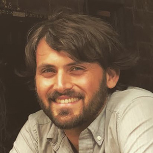
Daniel Sousa
 Associate Professor of Geography
Storm Hall 304C | [email protected]
Curriculum Vitae | Personal Web Site
Dan Sousa and his students use remote sensing to characterize and model biological, chemical, and physical Earth surface processes. A core component of this research addresses methodological questions of synthesizing observations made across widely varying spatial scales and electromagnetic regimes. This work integrates advances in sensor engineering (e.g. imaging spectroscopy) with novel analysis approaches (e.g. manifold learning and spatial networks).
Research applications include:
- Wildfires
- Terrestrial ecology, conservation, and biodiversity
- Evapotranspiration and agriculture
- Climate variability
- Water quality and human health
- Geologic mapping
- Data science and geophysical inverse theory
Dan grew up working as a manual laborer and crew supervisor on construction sites in and around Davis, CA. He has a BS from UC Davis and an MA and PhD from Columbia University. Previously, he has worked at research labs including NASA’s Jet Propulsion Lab (JPL) and Ames Research Center, the U.S. Naval Research Lab (NRL), and the National Center for Ecological Analysis and Synthesis (NCEAS). Dan also served one year as a NOAA Knauss Fellow in a California Congressional office on Capitol Hill. He has done fieldwork in over 10 countries and spent 6 weeks at sea on a geophysical research cruise in the waters offshore Hawai’i. He has also done freelance consulting work for small and large for-profit and non-profit clients.
Research in Dan’s lab is funded by a broad range of sponsors. For current details, please see https://www.dansousa.org/home/currentresearch.
Dan welcomes new graduate or undergraduate students interested in remote sensing. If any of the above sounds interesting to you, please get in touch!
- Ph.D., Columbia University
- M.A., Columbia University
- B.S., University of California, Davis
- GEOG 591/591L: Remote Sensing of Environment
- GEOG 592/592L: Intermediate Remote Sensing of Environment
- GEOG 688/688L: Advanced Remote Sensing of Environment
- GEOG 700: Research Design in Geography
- GEOG 780: Advanced Remote Sensing Seminar
- Understanding spatiotemporal landscape patterns using multi-scale imagery
- Imaging spectroscopy, manifold learning, and spatial network analysis
- Agriculture in the San Joaquin Valley
- Water quality in the Tijuana River Estuary and San Diego coastal ocean
- Arsenic contamination in smallholder rice farms in Cambodia